Nueces County
of
Texas
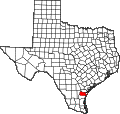
NUECES COUNTY. Nueces County (Q-17) is on the Gulf of Mexico southeast of San Antonio. It is bounded on the north by the Nueces River and on the east by the Laguna Madre, Corpus Christi Bay, and Redfish Bay. San Patricio County is on the north border, Jim Wells County on the west, and Kleberg County on the south. The county seat and largest city, Corpus Christi, is 210 miles southwest of Houston and 145 miles southeast of San Antonio. The center of the county lies roughly at 27°44' north latitude and 97°33' west longitude. Two major highways serve the county, Interstate 37 and U.S. Highway 77. Two railroads, the Missouri Pacific and the Texas-Mexican, cross the county.
Nueces County comprises 847 square miles of the Coastal Prairies region. The terrain is generally flat. The elevation ranges from sea level to 180 feet above sea level. In the central part of the county the soil varies from very dark loams to gray or black cracking clayey soils. In the west the soils are light to dark with loamy surfaces and clayey subsoils. In the coastal region the soils are sandy; in marsh areas the soils are also very dark with clayey subsoils. Vegetation varies from cordgrasses, salt grasses, and marsh millet along the coast to tall grasses, oak, prickly pear, acacias, and mesquite trees in the central and western parts of the county. Between 61 and 70 percent of the land in the county is considered prime farmland. The Nueces River drains the northern and western portions of the county, Oso Creek the central portion, and San Fernando and Petronila creeks the southern portion. The climate is humid-subtropical. Temperatures range from an average high of 93° F in July to an average low of 47° in January. The average annual rainfall is thirty inches. The growing season extends for an annual average of 309 days, with the first freeze in December and the last in early February. Crops include sorghum, cotton, hay, corn, wheat, watermelons, peaches, and pecans. Beef and dairy cattle and hogs are raised.
The area has long been the site of human habitation. Archeological artifacts recovered in the region suggest that the earliest human beings arrived around 6,000 to 8,000 years ago. Following these earliest inhabitants was a culture known as the Aransas. Aransas campsites, some dating back 4,000 years, have been found from Copano Bay, in Aransas County, to Baffin Bay, north of Kenedy County. The Aransas Indians, a nomadic hunter-gatherer people, appear to have left the Gulf Coast around A.D. 1200-1300. The region apparently remained uninhabited for 100 years, until the ancestors of the Karankawas moved there around A.D. 1,400. During historic times, the Coastal Bend area was occupied by several groups of Indians: the Coahuiltecans, Karankawas, Lipan Apaches, and Tonkawas. These groups were subdivided into numerous smaller bands: the Atakapa, Borado, Cavas, Capoque, Emet, Kohani, Kopani, Malaquite, Payaya, Sana, Tamique, and others. These nomadic hunter-gatherers shared a common linguistic basis but did not form larger alliances. After the arrival of Europeans most fled, succumbed to disease, or were absorbed by other indigenous groups; by the mid-1800s virtually all trace of them had disappeared.
The earliest Europeans to reach the area of the future Nueces County may have been the party of Alonzo Alvarez de Pineda, who reputedly reached Corpus Christi Bay on the feast of Corpus Christi, 1519. Conclusive evidence, however, is lacking because the records of his expedition are lost. Nine years later Alvar Nunez Cabeza de Vaca and his crew were shipwrecked on the Texas coast. Although Cabeza de Vaca's exact route is unknown, historians believe that some members of his party skirted Corpus Christi Bay. The Spanish, however, largely ignored Texas until the French, under René Robert Cavelier, Sieur de La Salle, established a colony in the region in 1685. Spanish authorities dispatched an expedition to the region in 1689 under Alonso De León, the governor of Coahuila. Corpus Christi Bay, however, remained unknown and unexplored until 1747, when Joaquín Prudencio de Orobio y Basterra, captain of the presidio at La Bahía, led an expedition down the Nueces River to its mouth, where he arrived on February 26. After his return, José de Escandón, governor and captain general of Nuevo Santander, proposed to found a settlement called Villa de Vedoya at the mouth of the Nueces. Indians living in the area were to be served by a mission named Nuestra Señora del Soto. In the summer of 1749 fifty families accompanied by a squadron of soldiers and two priests set out, but because of drought and poor provisions they never reached their goal. Several other attempts were made to found a colony at the mouth of the Nueces, but not until the 1760s, when ranchers from Camargo, Nuevo Santander (now Tamaulipas), pushed northward in search of new grazing lands, did the first Spanish settlers reach the area. The first settlement was founded by Blas María de la Garza Falcón, captain of Camargo, who in 1766 established a ranch called Santa Petronila, on Petronila Creek. In 1787 Manuel de Escandón, the son of José de Escandón, proposed another settlement at the mouth of the Nueces, but the project never advanced beyond the planning stages. In the late 1780s and early 1790s Spanish authorities also considered moving Nuestra Señora del Refugio Mission to the mouth of the Nueces, but abandoned the idea because of continuing friction with the Lipan Apaches. At the end of the eighteenth century ranchers from the Rio Grande valley began applying for and receiving land grants in the lower Nueces valley. By 1794 a large ranch belonging to Juan Barrera and known as Rancho de Santa Gertrudis was in operation on the north side of Corpus Christi Bay. Between 1800 and the end of Spanish dominion much of what is now Nueces County was granted to ranching families, most of whom were related by marriage. In 1812, after an Indian uprising, the colonists abandoned the area and sought refuge in the Rio Grande valley. The colonists returned, but repeated skirmishes with the Indians continued until about 1824, when peace was made with the Comanches and Lipans. After Mexican independence, the region became part of Tamaulipas. During the period from 1829 to 1836 most of the land in the lower Nueces valley that had not been granted under Spanish rule was deeded to individuals by the Tamaulipan government.
In 1830 new attempts were made to establish colonies in the area. Gen. Manuel de Mier y Terán proposed founding two towns near the mouth of the Nueces. One settlement was to be located at the site of present-day Corpus Christi, but it was never realized. The other settlement, however, a military post known as Fort Lipantitlán, was established in 1831 in the northwestern part of the future county at the point where the road from Matamoros to Goliad crossed the river. During the remaining years of Mexican rule no other towns were established on the west bank of the Nueces, but in the 1820s two Irish colonies were founded on the east side of the river under contracts issued to James Power and James Hewetson by the state of Coahuila and Texas. In 1828 John McMullen and James McGloin obtained a grant to settle a tract of land along the east side of the Nueces ten leagues west of the coast. Later, some of these colonists and their descendents moved west of the river.
During the 1830s two further unsuccessful attempts were made to establish colonies at the mouth of the Nueces. German nobleman Baron Johan von Raiknitz attempted to found a German settlement on the west bank of the Nueces, but the ship carrying the colonists was prevented from landing by the French during the so-called "Pastry War" between France and Mexico. A second ship transporting colonists from Germany was shipwrecked. Around the same time abolitionist Benjamin Lundy proposed to established a colony for freed slaves, but the plans were abandoned after the outbreak of the Texas Revolution. During the revolution, Texans under Ira Westover captured the Indian village of Lipantitlán, which was later occupied by Francis W. Johnson and the New Orleans Greys. After the revolution, the area south and west of the Nueces River was a no-man's-land. Texas claimed the territory, but Mexico said it was part of Tamaulipas. Neither exercised effective control. Both Texan and Mexican raiding parties made periodic forays into the region between 1838 and 1841. Mexican Federalist forces twice sought sanctuary at Fort Lipantitlán in the late 1830s, and in 1838 Gen. Antonio Canales organized his army for the Republic of the Rio Grande nearby.
During this period both Mexican and Texan merchants engaged in illegal trading in the Nueces valley. Among the most prominent of these was Henry Lawrence Kinney, who established a trading post and fort on Corpus Christi Bay in 1839. The land belonged to Capt. Enrique Villarealqv, a rancher from Matamoros, who had obtained it in 1832. Villareal led a force of 300 men to confront Kinney in 1841. Kinney, however, managed to negotiate an agreement and purchase the land from him. The small settlement soon became the focus of trade in the area. Repeated attacks by Mexican bands forced Kinney to abandon the post in 1842, but he returned a short time later and reestablished his trading business. A post office opened in 1842 with William P. Aubrey as its postmaster. The population of the small settlement—now known as Corpus Christi—boomed briefly when Gen. Zachary Taylor's army arrived there in September 1845, but it quickly shrank again after the Mexican War.
Nueces County, including the entire area south of Bexar County west to the Rio Grande and east to the Gulf of Mexico, was formed from San Patricio County in 1846 and organized the same year. Corpus Christi, which was incorporated in 1846, became the county seat. The population of the county, however, remained small. Although large numbers of fortune-seekers passed through Corpus Christi to join wagon trains heading west during the California gold rush of 1849, few settlers put down roots. Continuous Indian attacks and the relative isolation of the region kept away most would-be settlers. The first census of the county in 1850 showed a population of 689. Between 1850 and 1861 the Nueces County area was further divided to form several new counties.
Kinney, who continued to promote Corpus Christi, organized a major fair in the town in 1852, reportedly the first state fair in Texas. Despite extensive preparations, however, it proved to be a failure. Two years later, yellow fever decimated the population. Nonetheless, the early 1850s saw the construction of a county courthouse and jail and the beginnings of regular county government.
The mainstay of the local economy in late antebellum Texas remained ranching. Between the Texas Revolution and the late 1840s the area's ranches had been virtually abandoned. After the Mexican War the land grants of Mexican ranchers in the region were gradually acquired by Anglos who reestablished the cattle and horse industries. Tax rolls in 1848 reported only 647 cattle and nineteen horses. By 1860, however, records showed 56,454 cattle and 8,554 horses and mules worth an estimated $489,520. Farming was not extensive and was only for subsistence.
During the early years of the Civil War, Corpus Christi was an important center for Confederate commerce. In 1859 no fewer than forty-five small vessels carried trade between Corpus Christi and Indianola. Small boats sailing inside the barrier islands transported goods from the Brazos River to the Rio Grande, while inland cotton was moved along the Cotton Road through Banquete to Matamoros and the mills of England. In an effort to halt the trade, Union forces seized control of Mustang Island in the fall of 1863. Corpus Christi was twice bombarded by federal gunboats, but the overland trade continued without interruption until the end of the war.
Although Nueces County escaped the destruction that devastated other parts of the South, the war years were difficult for the county's citizens, who were thwarted by the lack of markets and the wild fluctuations in Confederate currency, as well as by concern for combatants. After the war Nueces County residents experienced a protracted period of lawlessness and violence. Although the black population before the war had been very small and no Ku Klux Klan chapter was organized in the county during Reconstruction, political violence was commonplace, as Republicans and former Confederates struggled for control. Turmoil continued along the Mexican border, and cattle rustling and raids by bandits were frequent problems. In the end, however, because of its relatively small population, Nueces County was spared much of the fighting that other Texas counties experienced, and order was generally restored by the early 1870s.
The war and its aftermath also had a less serious effect on the county's economy than was the case in much of Texas. Land prices fell significantly, from fifty cents an acre in 1860 to twenty-eight cents an acre in 1869. But the boom in the cattle industry in the early 1870s helped Nueces County to overcome the postwar economic depression. In 1871 local tax rolls showed 218,969 cattle worth more than $942,000, more than four times the number from 1860. The cattle were shipped to market by two main routes: by water to New Orleans and Havana, or overland to Kansas, where they were shipped by rail to the East. During the early 1870s some ten meat-packing plants operated in Nueces County, but most were closed by the middle of the decade because the cattle drives proved to be more profitable.
Mustangs and other horses also contributed to the county's new prosperity; in 1871 there were 34,077 horses and mules in the county. But the greatest competition to the cattle industry came from sheep ranching. Before the ranges were fenced, Nueces County was an important center for wool production. During the late antebellum period, the number of sheep had been relatively small, with some 35,000 reported in 1860. By 1871, 363,835 sheep were counted, and by 1876 the number of sheep topped 650,000. In 1875 and 1876 the assessed value of sheep in the county actually exceeded that of cattle. Falling wool prices in the 1880s, however, and the advent of fencing eventually caused the sheep industry to decline. But for a number of years between the mid-1870s and early 1880s Nueces County led all Texas counties in the number of sheep and cattle.
During the latter half of the nineteenth and the early twentieth centuries, the population of Nueces County grew markedly, particularly in the decade after the turn of the century. In 1860 the county had only 2,906 residents, but the number increased rapidly in the post-Civil War years, to 3,975 in 1870, 7,673 in 1880, 8,093 in 1890, 10,439 in 1900, and 21,955 in 1910. Much of the population was centered in and around Corpus Christi, which gradually emerged as the commercial hub of the region. As the city grew in importance as a shipping center, efforts were made to improve access to the ocean. In 1874 the main sea channel was dredged to a depth of eight feet to allow large steamers to navigate. During the mid-1870s construction also began on the county's first railroad, a narrow-gauge line from Corpus Christi to Laredo. After its completion in 1881 a second line was begun, the San Antonio and Aransas Pass, which was completed in 1886 and extended from Corpus Christi to San Antonio.
The mid-1880s also witnessed the beginnings of cash-crop agriculture in Nueces County. During the late 1870s and early 1880s livestock raising in some areas of the county began to be supplanted by more traditional farming, particularly of cotton and vegetables. The growth of such farms began the breakup of the huge expanses of pastureland in the county and spelled the beginning of the end of the old cattle-ranching life. In 1889, 1,010 bales of cotton were produced; by 1910 the figure had grown to 8,566, and by 1930 Nueces County was among the leading cotton-producing counties in the state, with 148,442 bales.
Although cotton was the dominant crop during the early decades of the twentieth century, Nueces County farmers also produced large quantities of vegetables, including cabbage, onions, spinach, carrots, cucumbers, and turnips. The transition to cash-crop farming brought dramatic changes in land tenure. While large ranchers had predominated during the antebellum and early postwar period, by the turn of the century the land was increasingly worked by tenant farmers. In 1910, when agriculture was still developing in the county, only 35.3 percent of farmers were tenants, below the statewide average of 52.6. By 1925, however, 76.4 percent of all Nueces County farmers were tenants. The majority of the leaseholders were Anglos, but much of the labor was performed by Mexican Americans who were poorly paid and frequently lived in poverty.
During the 1920s agricultural mechanization began in the county. Tractors and other machines appeared in increasing numbers, and by the eve of World War II Nueces County farms were among the most mechanized in the state. The onset of the Great Depression, falling cotton prices, and the arrival of the boll weevil brought new hardships for county farmers. Many were forced to move to the cities. The total number of farms in the county fell from a high of 1,969 in 1930 to 1,306 in 1950. Cotton production, which had peaked during the mid-1920s at more than 100,000 bales a year, fell markedly during the 1930s and early 1940s. In 1945, only 46,000 bales were ginned. Cotton farming rebounded in the late 1940s, and in 1949 production once again topped the 100,000-bale mark. Since that time cotton production has declined, though it remains a significant part of the county's agricultural receipts. Truck farming flourished in the 1950s, but was afterward increasingly replaced by sorghum, which in the 1980s and 1990s was the county's largest crop. The decline in cotton and truck farming in the post-World War II era also forced many tenant farmers to leave the land or to hire out as agricultural workers. In the 1980s the economic base of the county, outside of the Corpus Christi area, was still overwhelmingly agricultural. In 1982, 85 percent of the county was in farms and ranches, with 77 percent of the land under cultivation and 1 percent irrigated. Nueces County ranked twenty-ninth in the state in agricultural receipts, with some 87 percent coming from crops.
Another important sector of the Nueces County economy in the twentieth century has been oil and natural gas. In 1922 natural gas was discovered in Nueces County, and a few years later several major oilfields were developed. Gas-recycling plants and carbon black plants, as well as oil refineries, are located in the county. Total oil production in the county from 1930 to January 1, 1989, was 533,831,701 barrels. Soda and salts of several varieties are produced from raw materials chiefly from Duval County. Other industries include a Celanese chemical plant and copper and lead refineries.
In 1926 the port of Corpus Christi was opened. The legislature made the port a state project by allocating the taxes from seven adjacent counties for the construction of breakwaters, jetties, and other ancillary improvements. The channel from the Gulf of Mexico to the turning basin is a part of the Gulf Intracoastal Waterway, which connects the port with cities of the Mississippi valley as well as with foreign markets and makes it potentially one of the chief ports of America. In 1935 the depth of the channel was increased to thirty-five feet so that large ships could be accommodated. The 1930s and 1940s also brought improvements in the transportation network of the county. By 1940 most of the major roads in the county were paved, and U.S. Highway 77 and State highways 44 and 286 had given farmers better access to markets.
The military importance of the area has been recognized since the time of the Mexican War, when Fort Marcy, the first federal post activated on Texas soil, was established. At one time Nueces County had five federal forts; Corpus Christi was a supply depot until 1857. On March 12, 1941, with the establishment of the Naval Air Station, Corpus Christi, the town became the home of the so-called "University of the Air."
Since World War I Nueces County has shown a remarkable growth in population, increasing from 22,807 residents in 1920 to 165,471 in 1950 and to 237,544 in 1970. In 1991 the reported population of the county was 296,527. Hispanics were about 50.5 percent of the population, non-Hispanic whites 44.1 percent, and African Americans 4.4 percent. The largest towns were Corpus Christi, Robstown, Port Aransas, and North San Pedro. During the early 1980s the county had thirteen school districts with sixty elementary, twenty middle, and fifteen high schools, as well as six special-education schools.
From the time of annexation to the 1950s, Nueces County remained solidly Democratic. Dwight D. Eisenhower won by a small margin in 1956, but Republicans otherwise failed to receive a majority of the county's votes until the election of 1972, when Richard Nixon defeated George McGovern, 41,682 to 33,277. Subsequently Democrats won the county in every presidential election except 1984, when Ronald Reagan outpolled Walter Mondale by a small margin.
The total number of businesses in the county in the early 1980s was 6,425. In 1980, 7 percent of workers were self-employed, 20 percent in professional or related services, 12 percent in manufacturing, 23 percent in wholesale or retail trade, and 10 percent in construction. In addition 5 percent were employed in other counties, and 14,911 retired workers lived in the county. Leading industries included tourism, agribusiness, general and heavy construction, oil and gas field services, meat packing, soft-drink bottling and canning, commercial printing, petroleum refining, ship building and repairing, and zinc refining. Also important were manufacturers of dairy products, bakery products, men's and women's clothing, plastics and resins, cement and ready-mix concrete, prefabricated metal buildings, oilfield machinery, and electronic components. Leading attractions in Nueces County include Padre Island National Seashore, Mustang Island State Park, the Texas State Aquarium, the Art Museum of South Texas , and the USS Lexington, a World War II aircraft carrier-museum in Corpus Christi Bay.
BIBLIOGRAPHY: Eugenia Reynolds Briscoe, City by the Sea: A History of Corpus Christi, Texas, 1519-1875 (New York: Vantage, 1985). Marvin Lee Deviney, The History of Nueces County to 1850 (M.A. thesis, University of Texas, 1935). Frontier Times, April 1949. Coleman McCampbell, "Nueces County Originally Covered Vast Area," Frontier Times, April 1935. Marker Files, Texas Historical Commission, Austin. Mrs. S. G. Miller, Sixty Years in the Nueces Valley, 1870 to 1930 (San Antonio: Naylor, 1930). Glenn A. Mitchell, The Geography of Nueces County, Texas (M.A. thesis, University of Texas, 1959). Margaret Sellers, The History of Public Schools in Nueces County (M.A. thesis, Texas College of Arts and Industries, 1957). Paul Schuster Taylor, An American- Mexican Frontier, Nueces County, Texas (Chapel Hill: University of North Carolina Press, 1934). Frank Wagner, ed., Fires and Hard Times (Corpus Christi: Friends of the Corpus Christi Museum, 1982). Bill Walraven, Corpus Christi: The History of a Texas Seaport (Woodland Hills, California, 1982). Bill Walraven, El Rincon: A History of Corpus Christi Beach (Corpus Christi: Texas State Aquarium, 1990).
Christopher Long
TXGenWeb State Coordinator:
Copyright © 2024 The TXGenWeb Project & contributors. All rights reserved.
USGenWeb Copyright Regulations